* Photo click ⇒ Enlarge in photo display field *
Mt.Hiuchigatake (2,356m) mountain climbing diary
August 15, 2020(Sat.) Fine
Miike Trailhead_1,530m➠ Map (5:58 3m) ⇒ Ozegahara branch(6:01 48m) ⇒ Hirosawatashiro_1,756m(6:49 34m) ⇒ 5合目(7:23 14m) ⇒ Kumasawatashiro__1,950m(7:37 24m) ⇒ 7/10 stage(8:01 23m) ⇒ 8/10 stage(8:24 8m) ⇒ 9/10 stage(8:32 15m) ⇒ Manaitagura summit_2,346m(8:47-8:51 20m) ⇒ Shibayasugura summit_2,356m(9:11)
Shibayasugura summit(10:06 20m) ⇒ Manaitagura summit(10:26-10:29 53m) ⇒ Kumasawatashiro(11:22-11:28 37m) ⇒ Hirosawatashiro(12:05 41m) ⇒ Miike Trailhead(12:46)
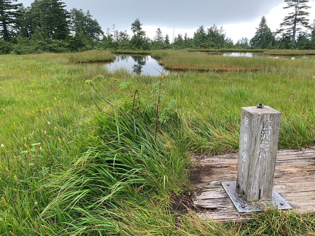
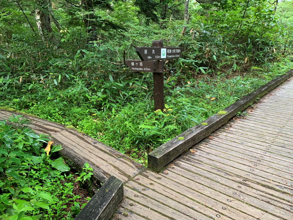
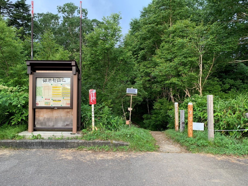 We stayed at Hinoemata hot spring the night before and started Miike Trailhead (behind the parking lot) before 6 o'clock in the early morning.The high ridges are gas, but the weather at the starting point is good.Proceed toward Ozegahara for about 3 minutes and find the Hiuchigatake branch signpost .There is a guide plate of Mt.Hiuchigatake 4.5km and Ozegahara 3.9km.On the mountain trail, wooden paths and rocky paths appear alternately, increasing the altitude.In about 50 minutes, you will arrive at the long and narrow wetland Hirosawa Tashiro (1,756m) dotted with ponds(jitou).There are only small yellow and white alpine plants, not gorgeous.The direction of travel is gas, but you can see the entire wetland.
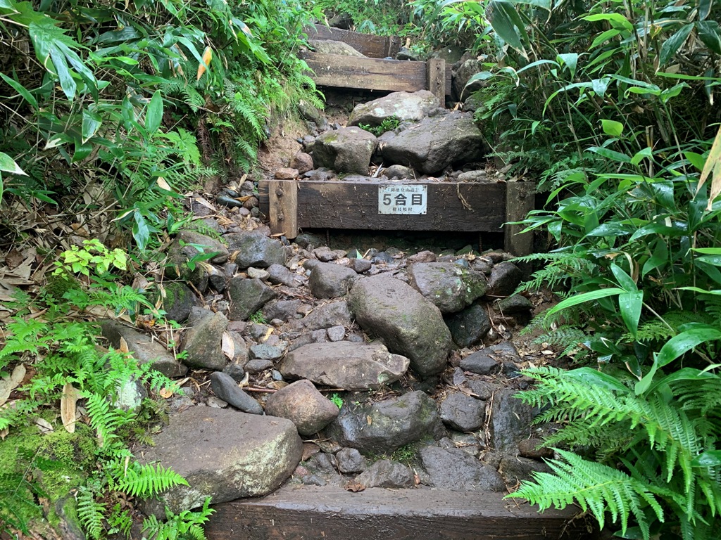
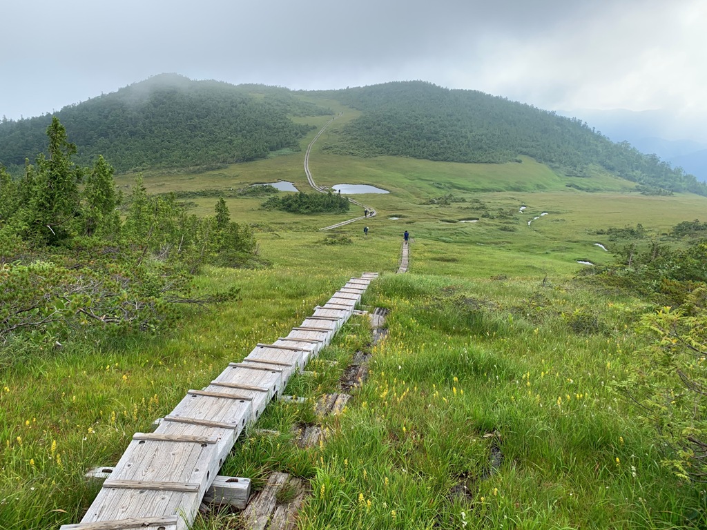
 As usual, wooden paths and rocky paths continue alternately.34 minutes from the resting point of Hirosawa Tashiro, pass the 5/10 stage signpost .Shortly after that, the view opens and can see the pond (jitou) and the grassland.A wooden path leading to Mt.Hiuchigatake crosses the grassland in two rows in a straight line.Arrive at the rest area of Kumasawa Tashiro in 1 hour and 39 minutes from the trailhead.From there, a wooden staircase continues to 7/10 stage .
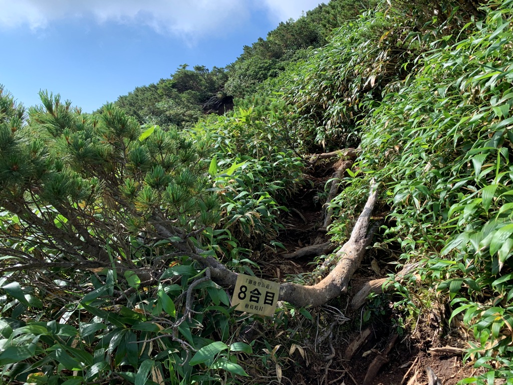 After passing through the bamboo field from the 7/10 stage, it becomes a steep slope with a rocky road.Pass the 8/10 stage and 9/10 stage signposts on rocky road like a swamp. Eventually, we arrive at the summit of Manaitagura (2,346m) , which has a second-class triangulation station and a shrine.

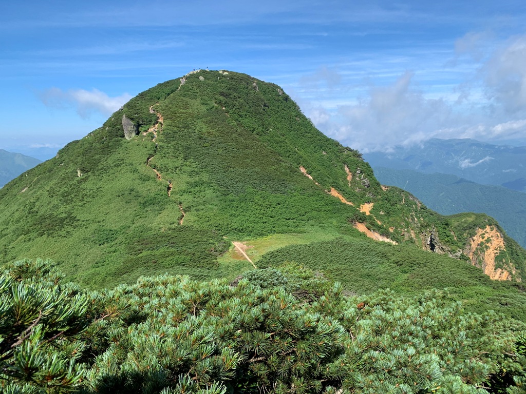
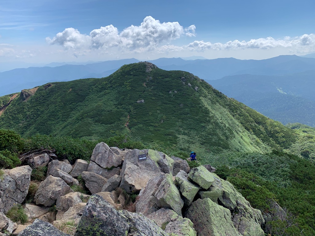
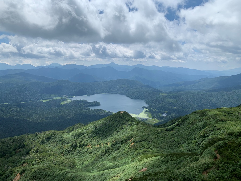
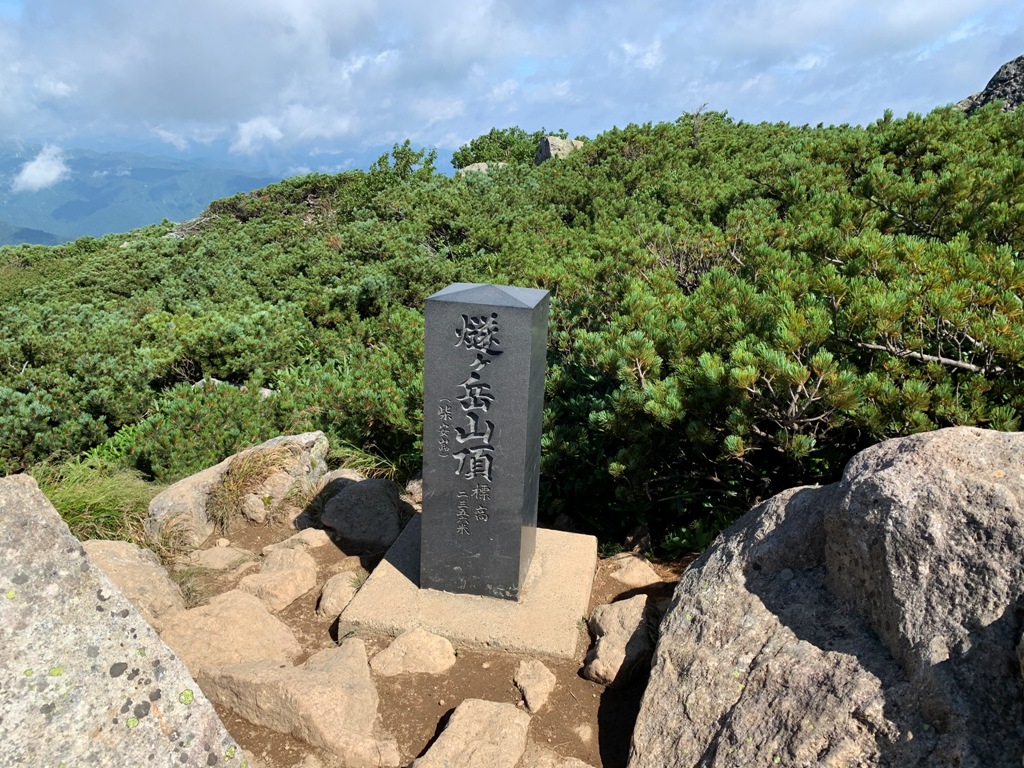 At the top of the mountain, the gas is completely gone, and Ozenuma can be seen up close.One of the two peaks, Shibayasugura , was also slightly covered with gas, but it was completely clear and visible in front of me.From there, we reach the highest peak of Mt.Hiuchigatake, Shibayasugra, the summit (2,356m) in 20 minutes.
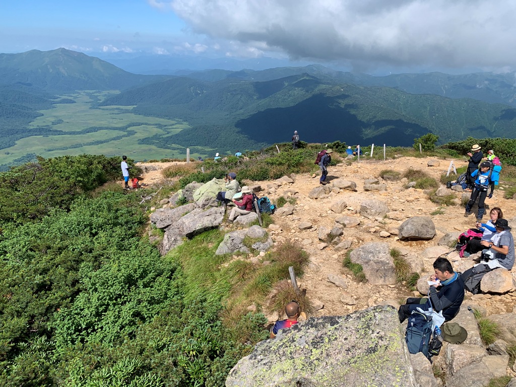
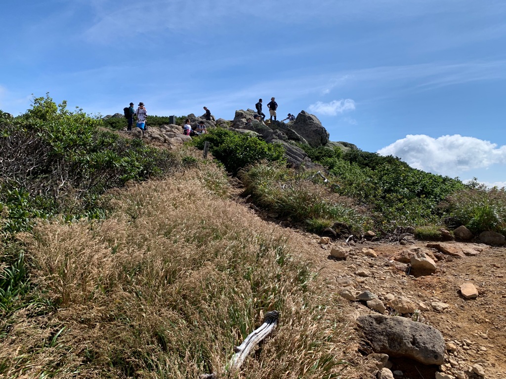 The summit is crowded with many climbers .From here, the Shibayasugura that you just climbed can be seen up to the climbers, and at the Manaitagura, it was hidden behind Shibayasugura The vast marshland of Ozegahara lies.Clearly see Mt.Shibutsusan in the back of Ozegahara, Mt.Shiranesan and Mt.Nantaisan in Nikkou on the Ozenuma side.
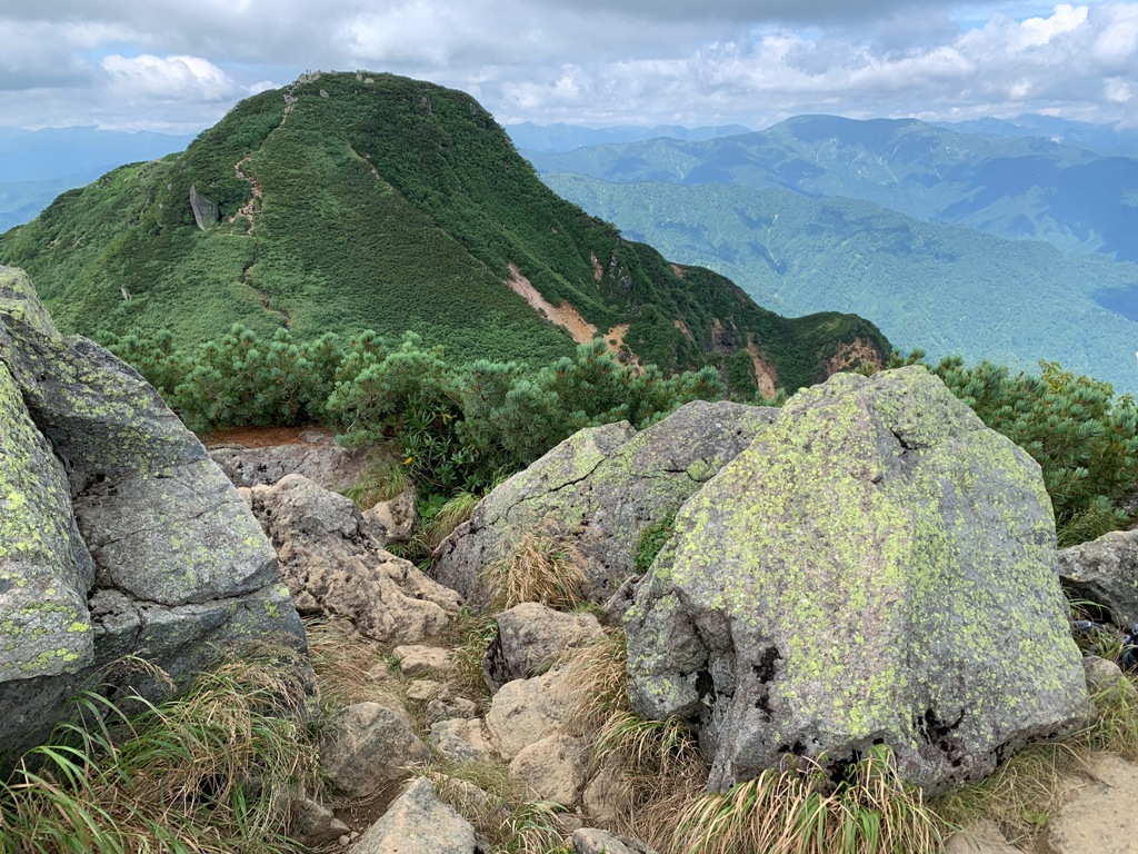
 The top of the mountain is windy, and while you are eating, your sweat gets cold and your body gets cold.Stay at the summit for about an hour and turn back.Go down the outbound route comfortably while looking at the Manaitagura and Ozenuma.Standing at Manaitagura for a while, looking back at Shibayasugura , Ozenuma spreading beyond Mt.Minobuchidake Look at it.Then, start descending toward Mt.Aizukomagatake.This mountain has a lot of irregular rocks, so you need to be more careful when descending.After the 7/10 stage, after a while, a large wetland of Kumasawa Tashiro opens.Take a short break at Kumazawa Tashiro, pass by Hirosawa Tashiro, and descend to the Miike trailhead in 2 hours and 17 minutes.Since the climb is 2 hours and 49 minutes, the round-trip time to Manaitagura is 5 hours and 6 minutes.