* Photo click ⇒ Enlarge in photo display field *
Mt.Asamakakushiyama (1,756.7m) mountain climbing diary
June 22, 2014 (Sun.) Cloudy after rain
Trailhead➠ Map (12:30 12m) ⇒ Second point(12:42 5m) ⇒ 3rd point(12:47 53m) ⇒ Mt.Asamakakushiyama(13:40)
Mt.Asamakakushiyama(14:00 40m) ⇒ Trailhead(14:40)
Until a few days ago, I was planning to climb Mt.Asamakakushiyama and Mt.Hanamagariyama after the Kitakaruizawa Marathon on June 22nd.However, it rained heavily nationwide on that day, and it was raining to hit the car around 6 o'clock when we arrived at the parking lot Kitakaruizawa Fureai Square.The motivation of the marathon itself goes down, not just the mountain climbing.Fortunately, it changed to light rain from around 7 o'clock, and that condition continued during the marathon competition from 9 o'clock.The rain stopped by the time I finished running.Moreover, Mt.Asamakakushiyama was peeping through the clouds.
Therefore, I decided to climb Mt.Asamakakushiyama as planned.The national highway to the trailhead was closed during the competition, so I managed to pass through the section with a navi through the Kitakaruizawa villa, crossed the Nidoue pass at the trailhead of Hanamagariyama, and arrived at the trailhead of Mt.Asamakakushiyama at 12:20.The rain had completely stopped and several cars were parked in the parking lot.
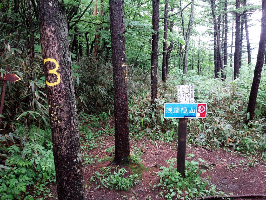
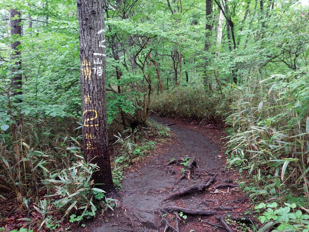
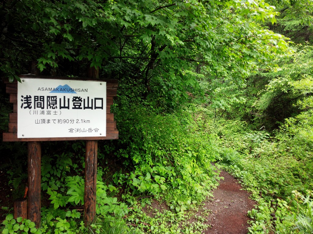 I left climbing entrance at 12:30.I thought it would get soaked with drops, but I didn't have to worry about it because the mountain trail was well maintained.On the way, the mountaintop, exit, second point, third point, steep slope, sloping slope, etc. were displayed on the tree trunk with yellow paint.There were short cut mountain trails here and there. When I climbed to Third point at once, a gentle descent continued for a while.I heard that the climbers I met so far were a couple and I could see Mt. Asamayama from the summit.
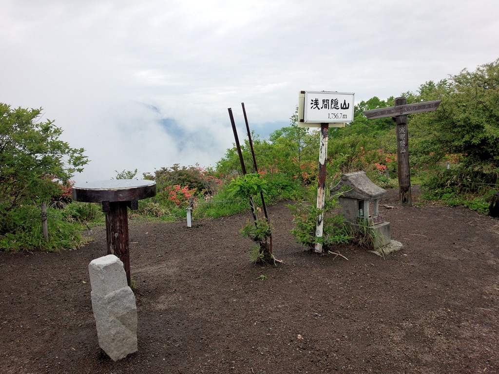 The slope became a little steep, so the marathon made my legs heavier.It got worse and I often took a short break.Near the summit, I met a group of climbers and a climber with children.I arrived at the summit of Mt. Asamayama in 1 hour and 10 minutes, but my legs were fluttering.A couple was resting at the summit.Mt. Asamayama was covered with clouds and appeared slightly.There were a lot of clouds and it was a waste of time even if it was long, so I took a break for about 20 minutes and started descending.Overtaking the couple who descended earlier, and overtaking the previous two climbers, we arrived at the trailhead in 40 minutes.
I gave up climbing Mt. Hanamagariyama and decided to sweat at the Kurabuchi "Aimakawa Onsen Fureaikan".
Nearest hot spring
Gunma pfecture
Kurabuchi Aimakawa Onsen Fureaikan(027-378-3834)➠ Map
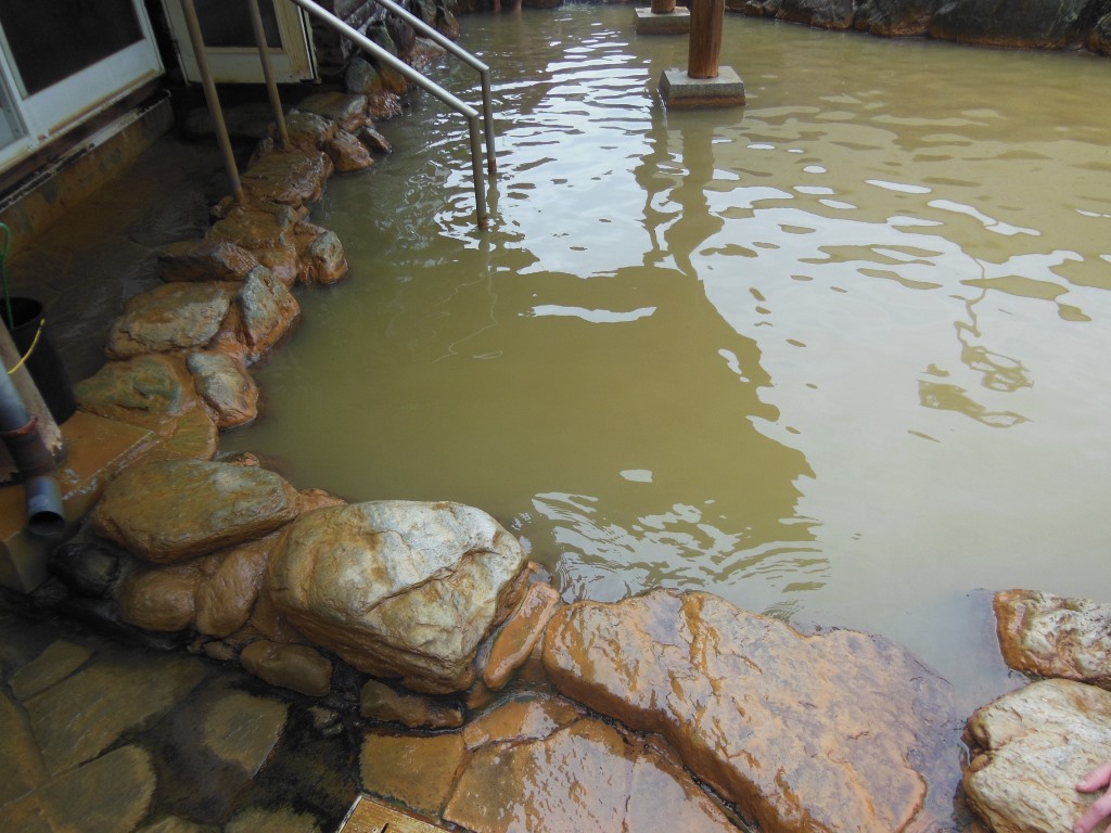
The open-air bath is called the iron-rich reddish-brown "Kinsen", and the indoor bath is called the transparent "Ginsen" that is filtered.The open-air bath is characterized by being water-soluble iron and forming an oil film.
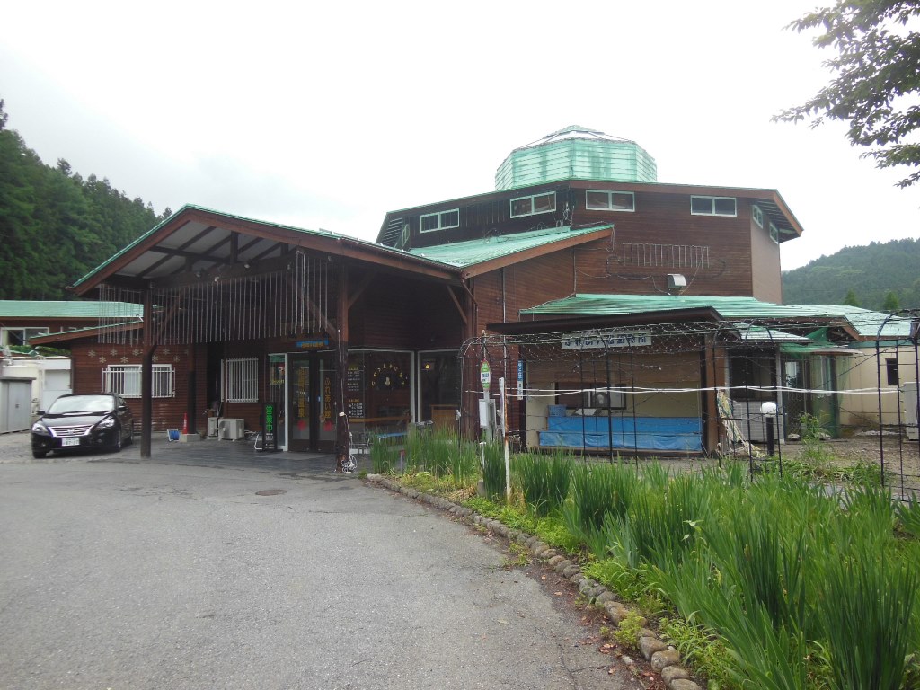
・Address:27 Mizunuma, Kurabuchimachi, Takasaki City,Gunma pfecture
・Bathroom:Indoor bath、Open-air bath
・Method:
・Spring quality:Na,Ca-chloride Strong salt temperature(63℃)
・Business hours:10:00~21:00
・Closing day:2,4 Tue.
・Bath charge:¥510
・Discount:Takasaki citizen ¥310
・Sightseeing spot:Lake Haruna、Kurabuchi Seseragi Park
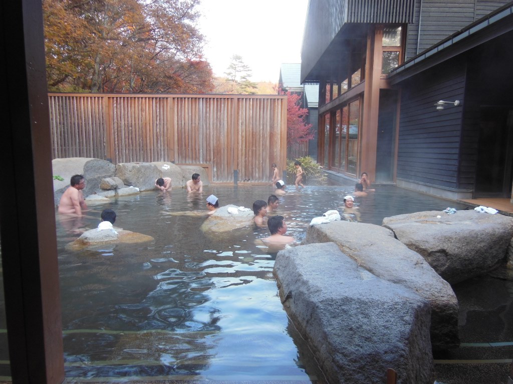
Hoshino Onsen Tonbo no Yu(0267-52-2515)➠ Map
It is a slightly expensive one-day hot spring near Karuizawa Station.The surrounding area is full of leisure facilities, so it is suitable for relaxing a day.
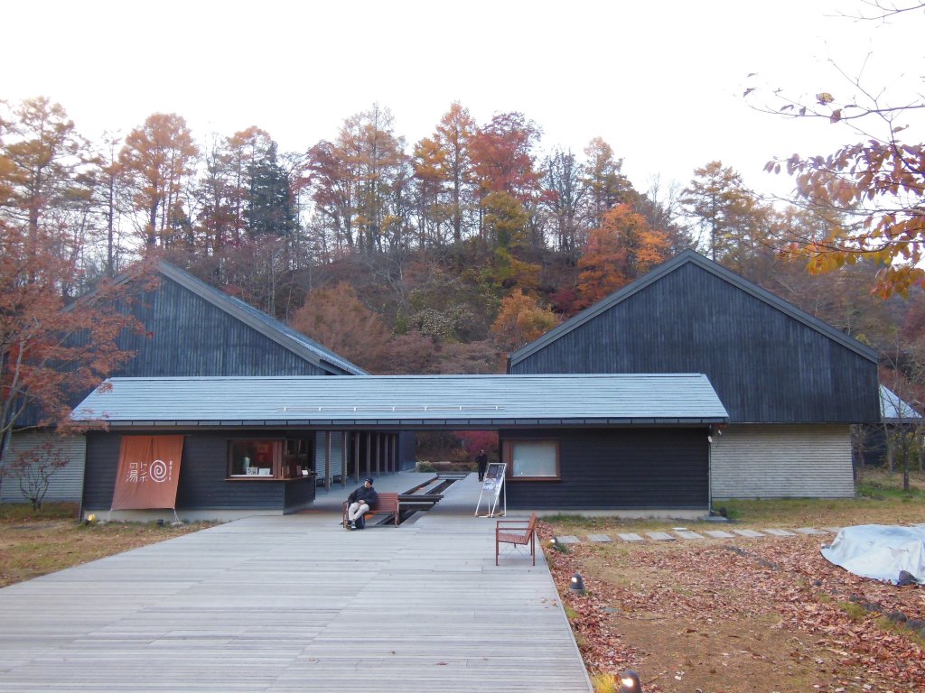
・Address:2148 Nagakura, Karuizawachou, Kitasaku District, Nagano Prefecture
・Bathroom:Indoor bath、Open-air bath、Sauna
・Method:Flowing over
・Spring quality:Na-Bicarbonate,Chloride spring(46.6℃)
・Business hours:10:00~22:00(Reception 21:15),7/18-8/31 Business hours extended
・Closing day:Open daily
・Bath charge:¥1350,GW and Aug ¥1550
・Sightseeing spot:Shiraito Falls、Onioshidashi Garden