* Photo click ⇒ Enlarged to the photo display column *
Mt.Ooasahidake(1,870m)Mountain climbing notes
September 5, 2016(Mon.) Fine, evening Rain
Mt. Ooasahidake trailhead➠ Map (5:30 16m) ⇒ Mikage Forest Branch(5:46 10m) ⇒ 2km point(5:56 44m) ⇒ 4km point(6:40 12m) ⇒ 2nd station_660m(6:52 21m) ⇒ 3rd station_850m(7:13 24m) ⇒ 4th station_1,060m(7:37-7:47 18m) ⇒ 5th station_1,200m(8:05 18m) ⇒ 6th station_1,369m(8:23 25m) ⇒7th station_1,500m(8:48 48m) ⇒ 9th station_1,760m(9:36 20m) ⇒ Mt.Ooasahidake_1,870m(9:56)
Mt.Ooasahidake_1,369m(10:35 30m) ⇒ 7th station_1,500m(11:05 13m) ⇒6th station_1,369m(11:18 13m) ⇒ 5th station_1,200m(11:31 16m) ⇒ 4th station_1,060m(11:47 18m) ⇒ 3th station_850m(12:05 17m) ⇒ 2th station_660m(12:22 1h 15m) ⇒ 2km point(13:37 19m) ⇒ Mikage Forest Branch(13:56 25m) ⇒ Mt. Ooasahidake trailhead(14:21)
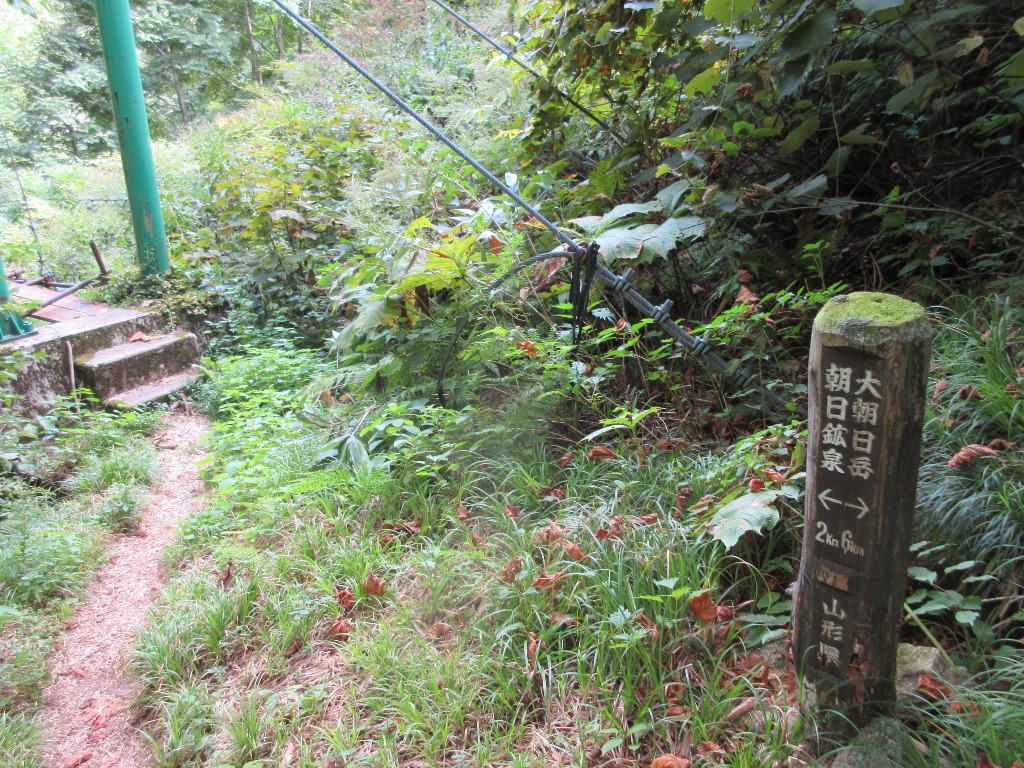
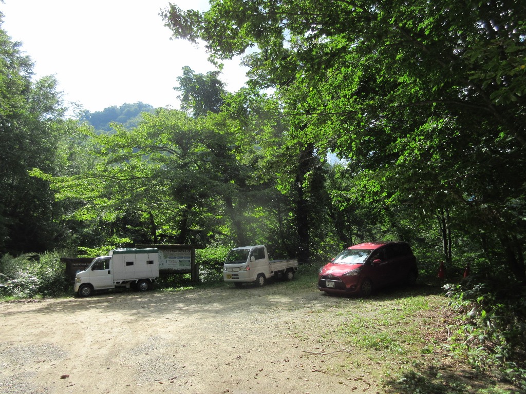
 Mt.Asahidake went to the trailhead in the past, but gave up due to the occurrence of bees. According to information from the Asahi mineral spring "Nakatsuru Course", Mt. Ooasahi dake(1,870m), the highest peak in the Asahi mountain range, has a total of 11 hours, 6 hours uphill, and 5 hours downhill. I chose "Medium Nakatsuru Course" because I was able to take a day trip on the shortest course. The day before, I passed the "14km sign to Asahi mineral spring" in Asahikawa Park around 19:00. It takes about 30 minutes to reach the Asahidake trailhead parking lot on a narrow, unpaved road. Stay in the car and prepare for an early departure in the morning.There were five cars in the parking lot. I'm start is 5:30, which was scheduled to leave around 4 o'clock. I was worried that it would get dark when I went down the mountain, so I decided to go early on the first flat section 4km.
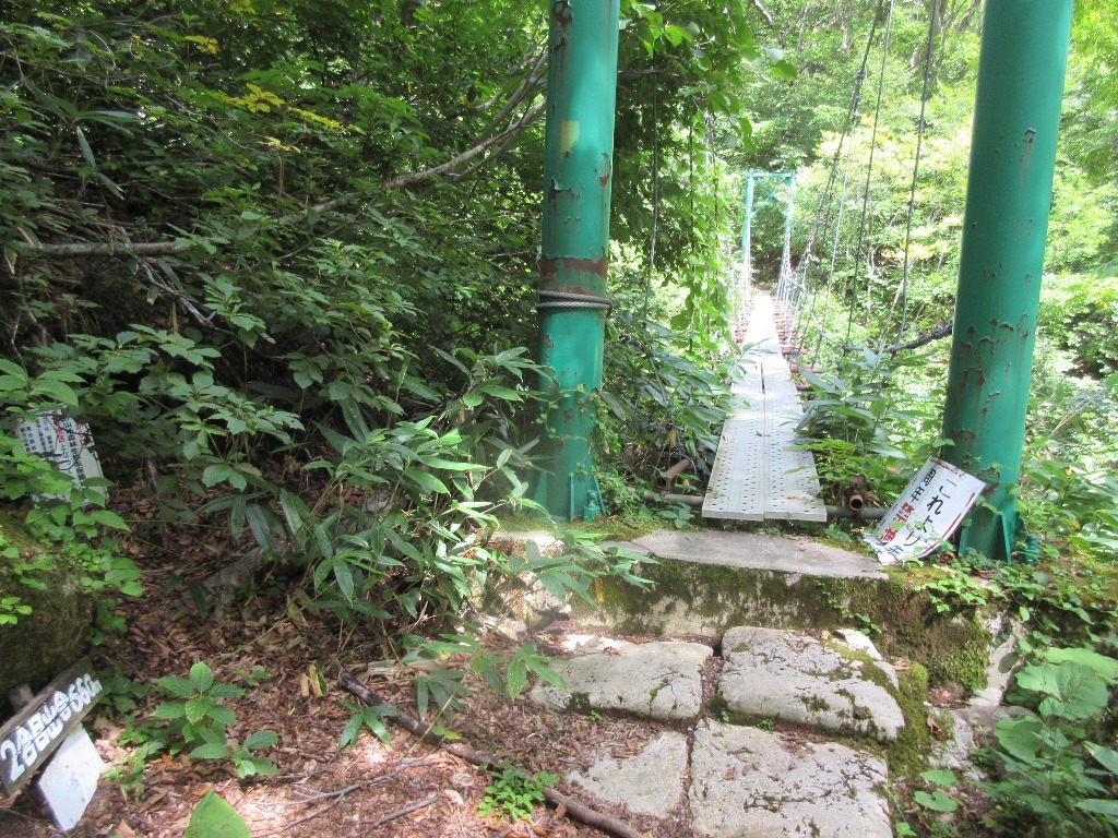
If you go down a little from the mountain trail next to "Asahi mineral spring Naturalist House" and cross the suspension bridge next to "Saruwatari Water intake", you will be guided to the mountain trail.The mountain trail passes through "Mt. Toriharayama" and "Mt. Mikagemoriyama" and continues through the beech forest along the main stream of the Asahi River.Crossing the suspension bridge is the 2Km point . It will be a good start with 26 minutes so far. From here, repeat the up-down a little and reach the 4km point in 1 hour and 10 minutes from the departure. Crossing two suspension bridges from there is the second point at an altitude of 660m .
Mt.Asahidake went to the trailhead in the past, but gave up due to the occurrence of bees. According to information from the Asahi mineral spring "Nakatsuru Course", Mt. Ooasahi dake(1,870m), the highest peak in the Asahi mountain range, has a total of 11 hours, 6 hours uphill, and 5 hours downhill. I chose "Medium Nakatsuru Course" because I was able to take a day trip on the shortest course. The day before, I passed the "14km sign to Asahi mineral spring" in Asahikawa Park around 19:00. It takes about 30 minutes to reach the Asahidake trailhead parking lot on a narrow, unpaved road. Stay in the car and prepare for an early departure in the morning.There were five cars in the parking lot. I'm start is 5:30, which was scheduled to leave around 4 o'clock. I was worried that it would get dark when I went down the mountain, so I decided to go early on the first flat section 4km.
If you go down a little from the mountain trail next to "Asahi mineral spring Naturalist House" and cross the suspension bridge next to "Saruwatari Water intake", you will be guided to the mountain trail.The mountain trail passes through "Mt. Toriharayama" and "Mt. Mikagemoriyama" and continues through the beech forest along the main stream of the Asahi River.Crossing the suspension bridge is the 2Km point . It will be a good start with 26 minutes so far. From here, repeat the up-down a little and reach the 4km point in 1 hour and 10 minutes from the departure. Crossing two suspension bridges from there is the second point at an altitude of 660m .
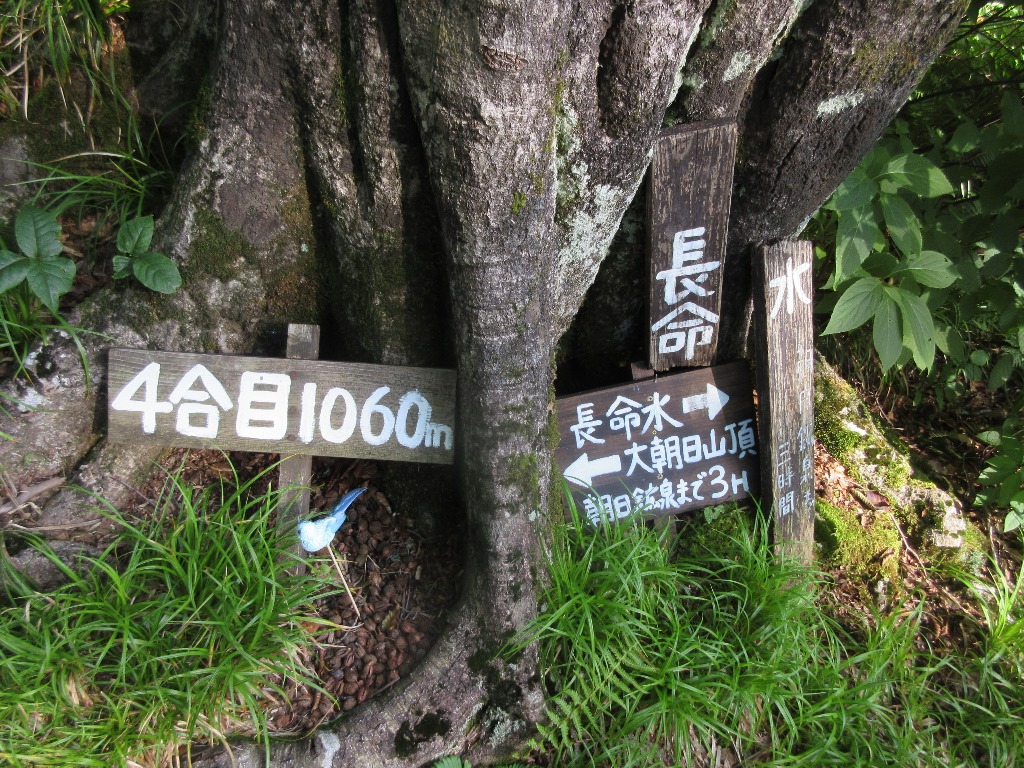
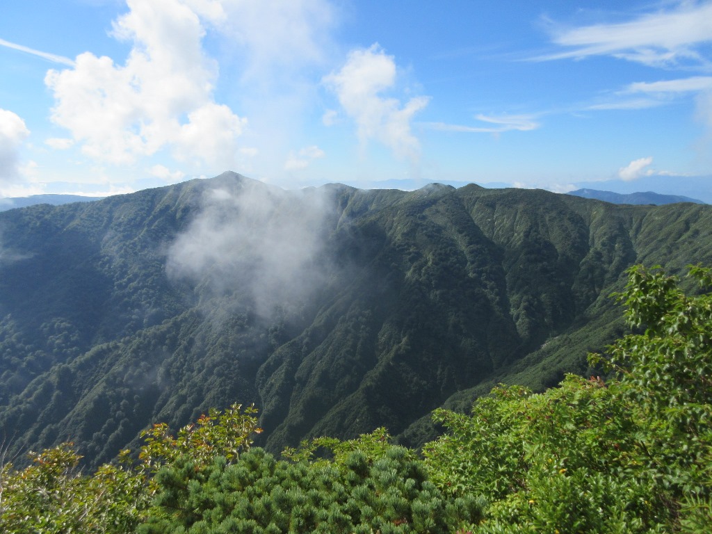
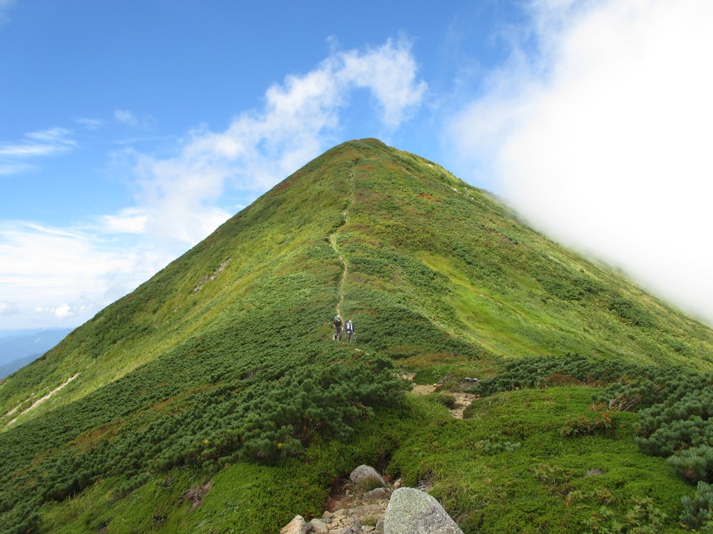
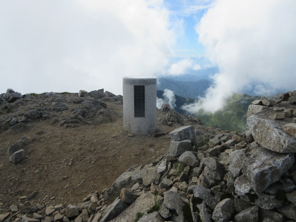 Finally, the remaining 4km and the altitude difference of 1,100m will start full scale climbing.Especially on the steep slopes from the 2/10 stage to the 4/10 stage, it has been easy so far, so it suddenly becomes painful.Rest for about 10 minutes at the Tyoumeisui branch of 4/10 stage .The slope becomes a little gentle, but the winding ridge walk continues.Occasionally, Mt.Koasahidake, Mikagemoriyama ridgeline opens, and the tiredness is healed.The pace gradually drops, but the field of view is gradually widening.The peak can be seen in front of you from the 9/10 stage, but Mt. Ooasahidake is beyond that.The summit is 9:56 and it takes about four and a half hours to reach the mountain.During that time, I didn't meet anyone, and Mt. OoAsahi daaaaake(1,870m) summit was monopolized.It took a little bit of gas, but I enjoyed the panorama from the summit for a while.After a while, a single climber and a climber with two climbed up.A single person climbs a day trip from Kotera Kousen. and two people stay at a mountain lodge and go down to the same Asahi Kousen as me.
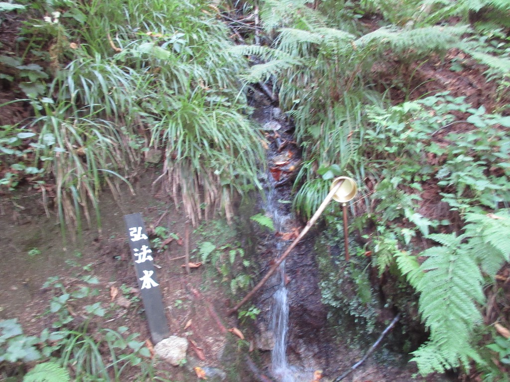
 It stays for about 30 minutes and starts descending at 10:35. I go down the mountain quickly ahead of two people . I've gained time on the uphill, so I can afford to go down. I walk while taking pictures of alpine plants that I didn't fully appreciate on the uphill. It takes 1 hour and 12 minutes from the summit to the 4th station and 1 hour and 47 minutes to the 2nd station. However, it was difficult from there. The mountain trail became a flat, but suddenly I came to my feet and it became difficult to walk. After all, the outbound route took 1 hour and 22 minutes, but the return route took 1 hour and 59 minutes. Even so, I was able to descend in 3 hours and 46 minutes and descend to the parking lot during bright hours. It was so hot that the water I brought wasn't enough, and it was a mountain trip helped by Sawa no Mizu . During this period, I was able to appreciate alpine plants, albeit slightly.
Nearest hot spring
Yamagata pfecture
Asahi mineral spring(090-7664-5880)➠ Map
・Address:Tachiki, Asahichou, Nishimurayama District, Yamagata pfecture
・Bathroom:Indoor bath
・Method:Add heat
・Spring quality:Chloride spring(19.8℃)
・Business hours:12:00~20:00(Mountaineering season)(Sat. and Sun.)12:00~20:00(Outside the season)
・Closing day:Irregular holidays
・Bath charge:¥500
・Sightseeing spot:Asahi River Valley、Kuuki shrine