* Photo click ⇒ Enlarged to the photo display column *
Mt.Amakazariyama(1,963m)Mountain climbing notes
September 20, 2013 (Fri.)
Fine
Trailhead➠ Map (7:40 1h 15m) ⇒Arasugesawa(8:55 3h) ⇒ Mt.Amakazariyama Hoppou(11:55 13m) ⇒ Mt.Amakazariyama Nanpou(12:08)
Mt.Amakazariyama Nanpou(13:31 2h33m) ⇒ Trailhead(16:04)
(GPS Data Trailhead→Mt.Amakazariyama Nanpou)
Distance:5.4Km、Time:4h13m、Altitude:up/1109M down/294M、
Average speed:1.27Km/h **
Including lost roads, excluding breaks**
(GPS Data Mt.Amakazariyama Nanpou→Trailhead)
Distance:4.3Km、Time:2h33m、Altitude:down/966M up/180M、Average speed:1.68Km/h
 I decided to climb Mt. Amashika because it had been fine weather after the typhoon and I thought it would be free before the consecutive holidays. The parking lot was already full.
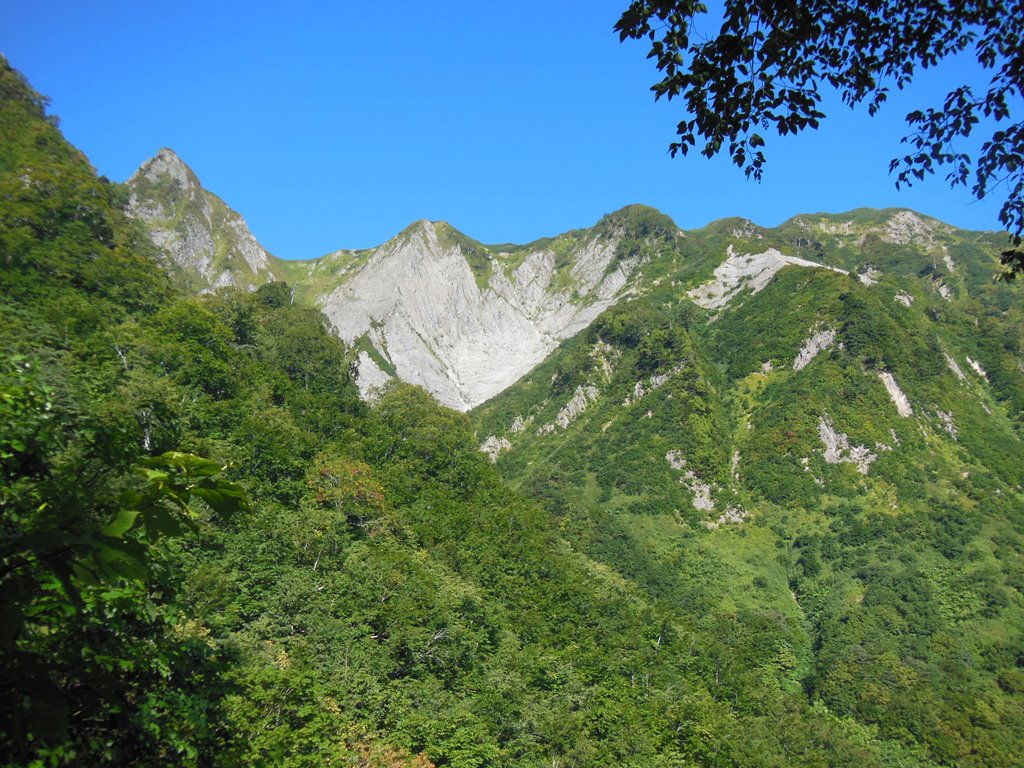
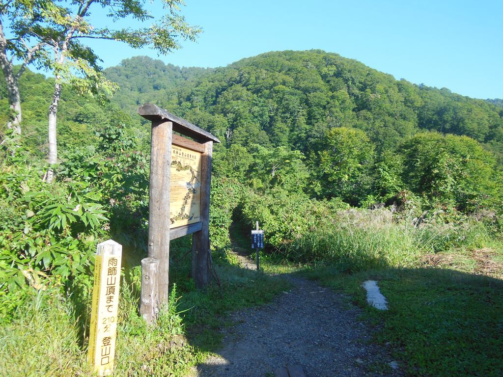
Start at the Amakazarikogen Campground climbing entrance on the Otari Spa. side at 7:40.There are 11 divisions on the trail, which are marked with "○/11", so that you can check your pace with that as the goal. After descending for a while, follow a flat wooden path until you reach the 2/11 point. From there, it suddenly climbs up, and when you go through the beech forest, you will reach the peak where you can see Arasugesawa and a huge rocky mountain.
We descended from there and reached "Arasugesawa" via 6/11.
It's been 1 hour and 15 minutes so far, so I thought it would be easy to reach the top in 3 hours. If you go straight through the stream, you will suddenly turn into a bush and you will notice the mistake. The mountain trail continued beyond the swamp, but at that time I did not recognize it, and for some reason I was unknowingly returning to the original road. When I met a climber who overcame me, I realized that I was backing for the first time. He returned almost to the peak and spent a considerable amount of time and extra physical strength.
 Find the arrow on the opposite bank of "Arasugesawa", cross the river, reconsider, and proceed smoothly on the steep slope that starts again. From around 7/11 when the visibility opened, it became a narrow ridge road with ropes and ladders. I feel good, but my legs suddenly feel heavy. As I climbed up the hill, I started to feel discomfort in my legs. Did I run out of energy because I climbed without eating breakfast? After going on a flat road for a while, I finally struck my leg, and the pain hurt me. So I was forced to take a long break.
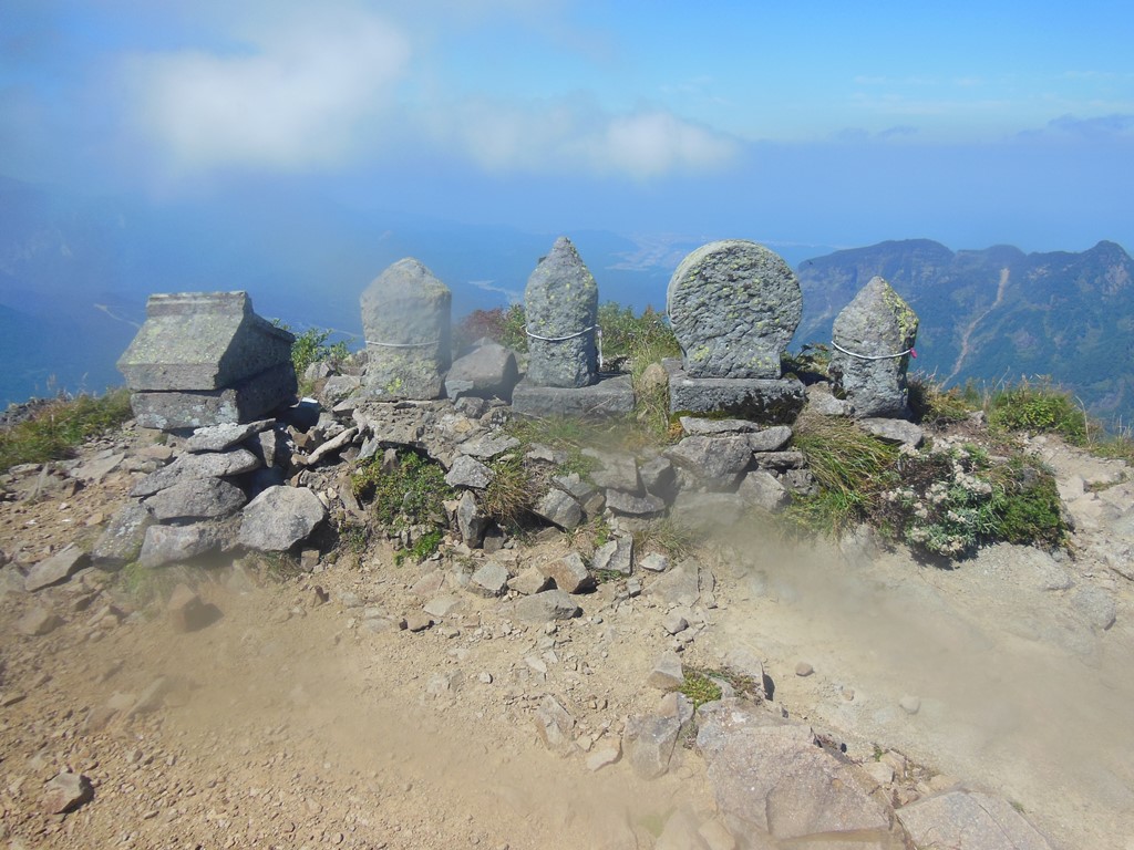
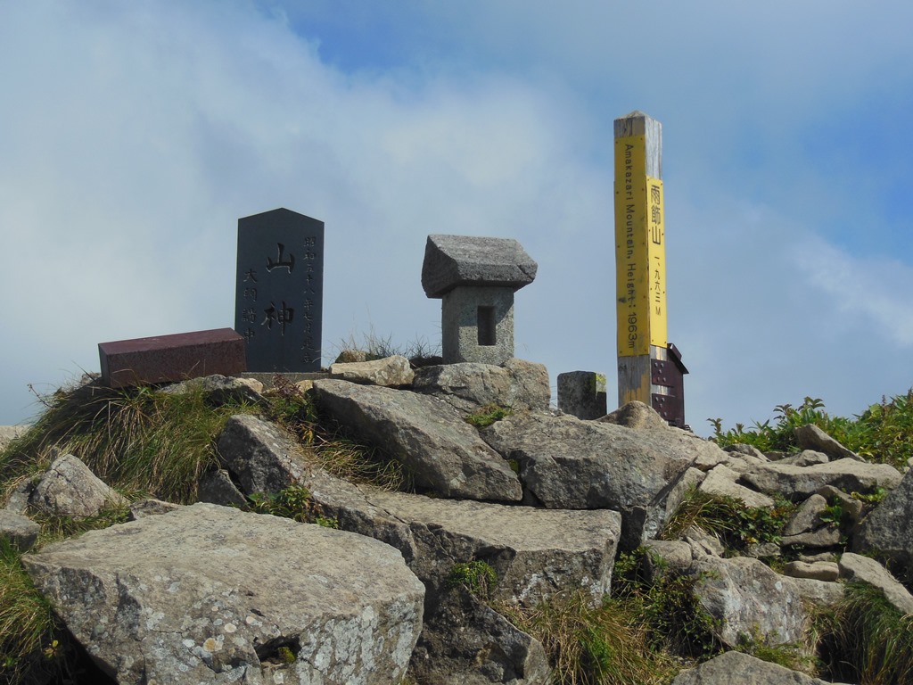
After all, it took 4 hours and 28 minutes to reach the south peak after passing "Amakazariyama Noth peak".From the top, a 360-degree view overlooks the Sea of Japan, Northern Alps, and the mountains of Hokushin.
Find the arrow on the opposite bank of "Arasugesawa", cross the river, reconsider, and proceed smoothly on the steep slope that starts again. From around 7/11 when the visibility opened, it became a narrow ridge road with ropes and ladders. I feel good, but my legs suddenly feel heavy. As I climbed up the hill, I started to feel discomfort in my legs. Did I run out of energy because I climbed without eating breakfast? After going on a flat road for a while, I finally struck my leg, and the pain hurt me. So I was forced to take a long break.
After all, it took 4 hours and 28 minutes to reach the south peak after passing "Amakazariyama Noth peak".From the top, a 360-degree view overlooks the Sea of Japan, Northern Alps, and the mountains of Hokushin.
My legs were not in good shape and I took a break for about an hour and a half including lunch. There were many climbers at the summit, but it became the final climber. I hung up a few times along the way, but I kept going down the mountain. Although I was feeling anxious, I was able to reach the camping ground in about two and a half hours after overtaking some people. I sweated at Amekaiso on my way back, but my legs are still hanging. It was a mountain trip that felt the year.
Nearest hot spring
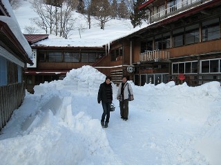
Otarionsen Yamadaryokan(0261-85-1101)➠ Map
This is a member of the Japan Secret Hot Springs Club. It is a great place to stay for mountain climbing. It is a hot spring resort that has a long history and features a sleeping hot spring.
・Address:18836 Nakachi, Otarimura, Kitaazumi District
・Bathroom: indoor bath, sleeping bath
・Method:Flowing over
・Spring quality:Na,Bicarbonate spring(48℃)
・Business hours:10:00~16:00
・Closing day:Open daily
・Bath charge:\500
・Sightseeing spot:Mt. Amakazariyama, Kamaike
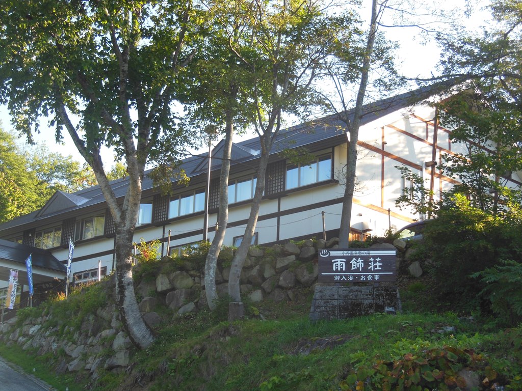
Otari Onsen Okunoyu Amakazarisou(0261-85-1607)➠ Map
It is a public inn that serves as a base for Mt. There is a forest open-air bath nearby, and you can take a bath with a short notice.
・Address: 18926-1 Nakachi, Otarimura, Kitaazumi District
・Bathroom:indoor bath、Open-air bath
・Method:Flowing over
・Spring quality:Na,Bicarbonate spring(58℃)
・Business hours:9:00~19:00
・Closing day:
・Bath charge:\600
・Sightseeing spot:Mt. Amakazariyama, Kamaike
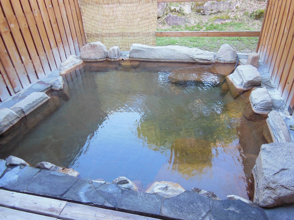
Amakazarisou Forest open-air bath(0261-85-1607)➠ Map
This is an open-air bath in the Amerikasou forest, just above the road. You can take a bath with a small amount of water and are separated by gender. Watch out for summer.
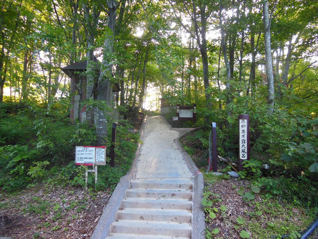
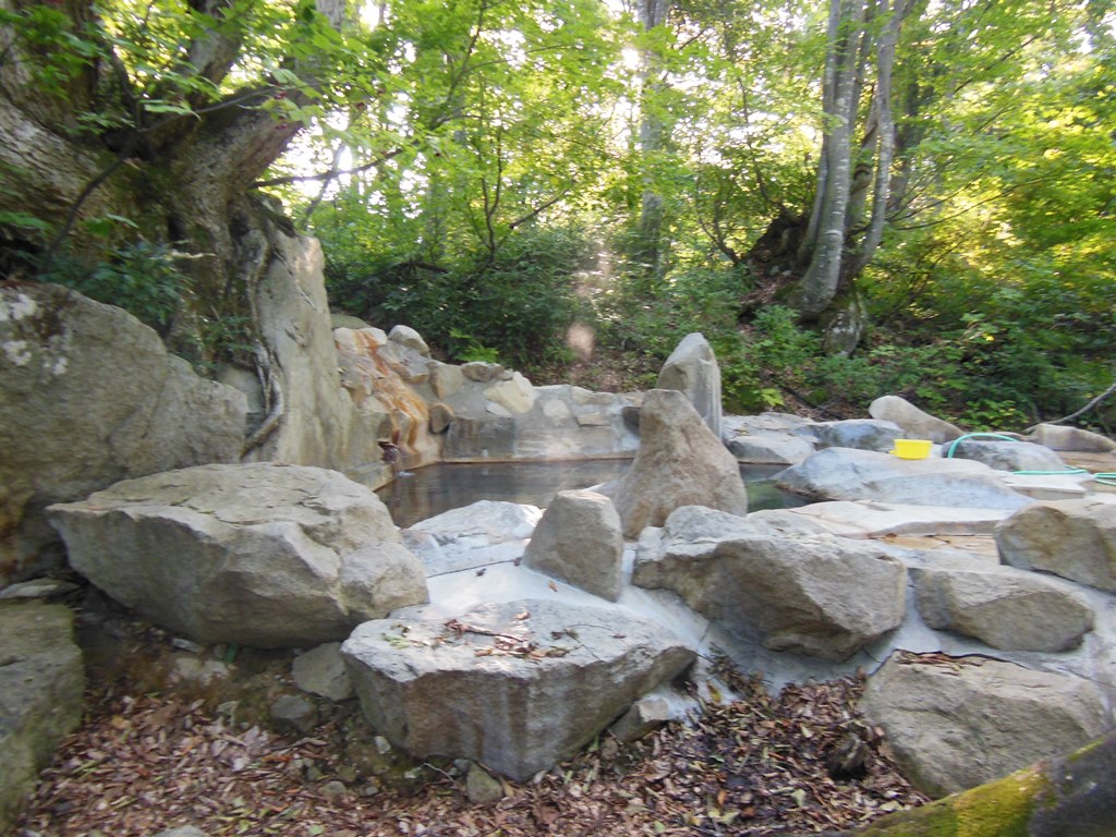
・Address:18926-1 Nakachi, Otarimura, Kitaazumi District
・Bathroom:Open-air bath
・Method:Flowing over
・Spring quality:Na,Bicarbonate spring(58℃)
・Business hours:10:00~21:00
・Closing day:November~April
・Bath charge:Donate
・Sightseeing spot:Mt. Amakazariyama, Kamaike